Professional Surveying & Geospatial Training
Comprehensive Geospatial Training Programs
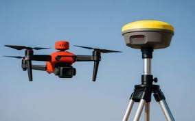
We offer professional training in GNSS surveying, total station surveying, drone mapping, 3D laser scanning, bathymetric surveying, AutoCAD, GIS, engineering surveying, and advanced LIDAR drone surveying.
Training Programs
- GNSS/GPS Surveying
- Total Station Operations
- Drone Mapping and Photogrammetry
- 3D Laser Scanning
- Bathymetric Surveying
- AutoCAD for Surveyors
- GIS and Spatial Analysis
- Engineering Surveying
- Advanced LIDAR Drone Surveying
Learning Approach
Our programs combine theoretical knowledge with hands-on practical field training, ensuring participants gain real-world skills in data collection, processing, and analysis.